11″x14″ Colored Map of the Town of St. Augustine, the Capital of East Florida 1777. Displayed on corrugated board and sealed in a protective sleeve stamped with the cities crest.

Town and Capital East Florida Color Map
$10.00
ST. AUGUSTINE – The Capital of East Florida
This print is an offset lithograph reproduced from an original published by Charing Cross, London, 1777. Original image size 8.5 x 11 in. Printed for William Faden, The North American Atlas, selected from the most authentic maps, charts, and plans, etc. hitherto.
William Faden was a cartographer and a publisher from England whose work is highly regarded to this day for its accuracy and detail. He was the successor of Thomas Jefferys as a geographer to King George III and Prince of Wales in 1773, a highly esteemed position. As an apprentice with the Jefferys family, Faden honed his skills, equaling his mentor’s ability as he took over the business. Faden’s maps of the American colonies during the American War of Independence are perhaps his best-known contributions to cartography during this period. By 1822 Faden had published over 350 maps, plans, and atlases, his North American Atlas being the most popular.
This map depicts the town of St. Augustine, at that time the capital of East Florida, then a British colony. The Fort, labeled St. Mark’s, is the focal point of the map, however, other elements such as the Cubo and Rosario Lines are equally significant. The view presented in this map has roots within the First Spanish Period and is strikingly similar to the map produced by the Spanish Cartographer Pablo Castello in 1763 before Florida was ceded to the British. Faden’s map clearly labels two divisions of land within the town as well as pastoral land on the outskirts. Labeled on the map, in addition to the fort, are the Church, Governor’s House, Parade, Guard House, Franciscan Convent, Parish Church, and the Dutch Church.
This map is significant because it gives an accurate portrayal of the city of St. Augustine in the late 1700s. When compared to older maps, the growth of the city and the density of the population is apparent. The river shown west of town, Maria Sanchez, was filled during the 1890s as the city expanded and developed. The Rosario Line, which runs along the western perimeter of the city, is now Cordova Street. The northern edge of the city, where the Cubo Line is shown, is now called Orange Street and borders the city gate, which still stands today. The National Guard now occupies the land where the Franciscan Convent once stood, now located on St. Francis Street. Faden’s map presents an important view of the nation’s oldest city during the British Period.
Related products
-

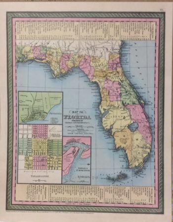
Florida 1850 Color Map
$10.00 — SKU: 13702-D -
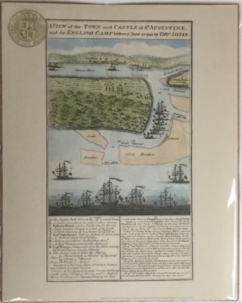
Town & Castle Silver 1740
$10.00 — SKU: 13702-F -
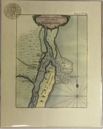
Plan Du Port Color Map
$10.00 — SKU: 13702-I -
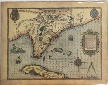
LeMoyne Florida Provincae Color Map
$10.00 — SKU: 13702-C